The crew left no drawing
The sprinkler installer finished in a day and took the plan with them.
 YardXray
Open the app
A private map of every pipe, wire, tank and sprinkler line on your property. Mark it once from your phone, and never guess where to dig again.
Start your map, freeWorks in your phone's browser. No app store, no account needed.
The sprinkler installer finished in a day and took the plan with them.
The gas line runs along the fence. Probably. Somewhere near the fence.
And the trench you dug for the shed's power is a fuzzy memory a year later.
Each one takes a minute in the yard. Together they're the record nobody else has.
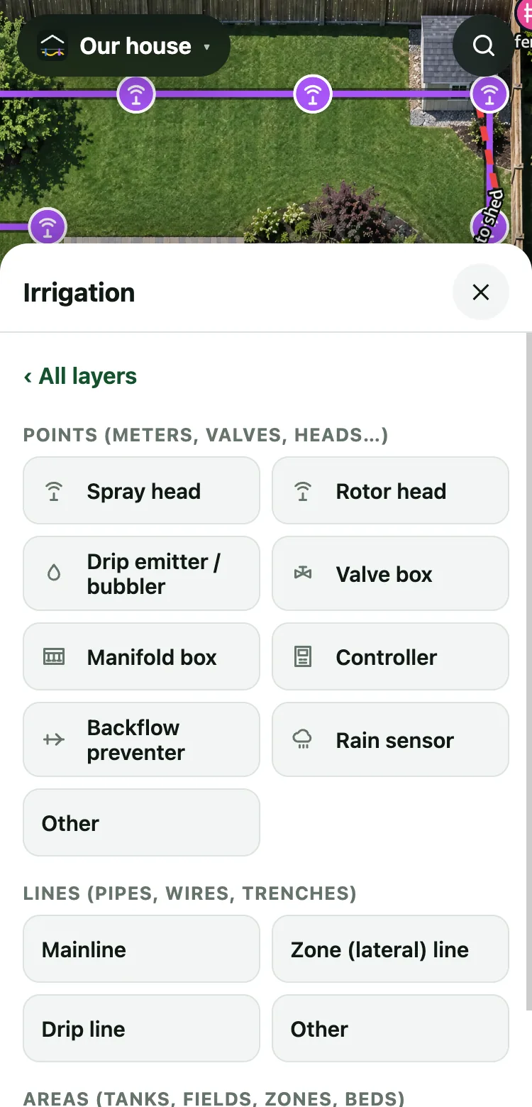
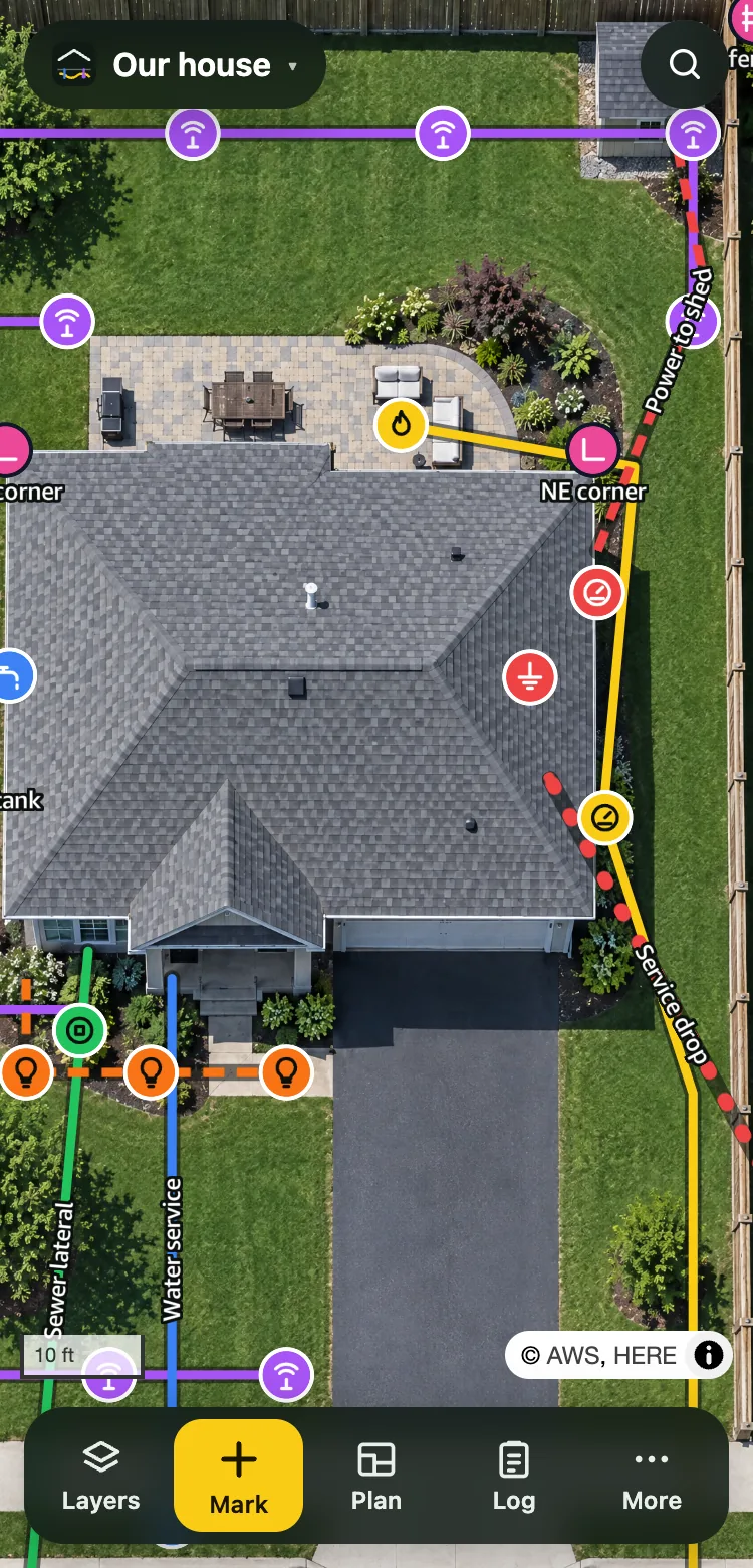
Tap to drop meters, valves and heads, or trace each pipe, wire and trench. Colors match the paint utility locators use, and every type has its own symbol.
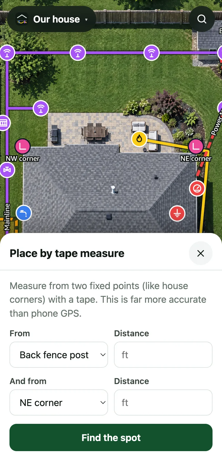
Phone GPS can be 10 feet off. Tape from two house corners or posts instead. Move a corner and everything measured from it follows.
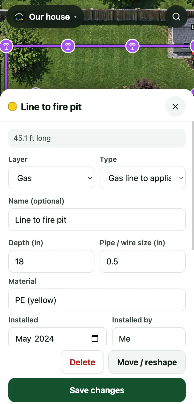
The open trench with a tape in the shot is the most useful photo of your yard you'll ever take. Add depth, size, material and who did the work.
Solid lines are measured or surveyed, dashed ones are estimates, and dotted ones run overhead.
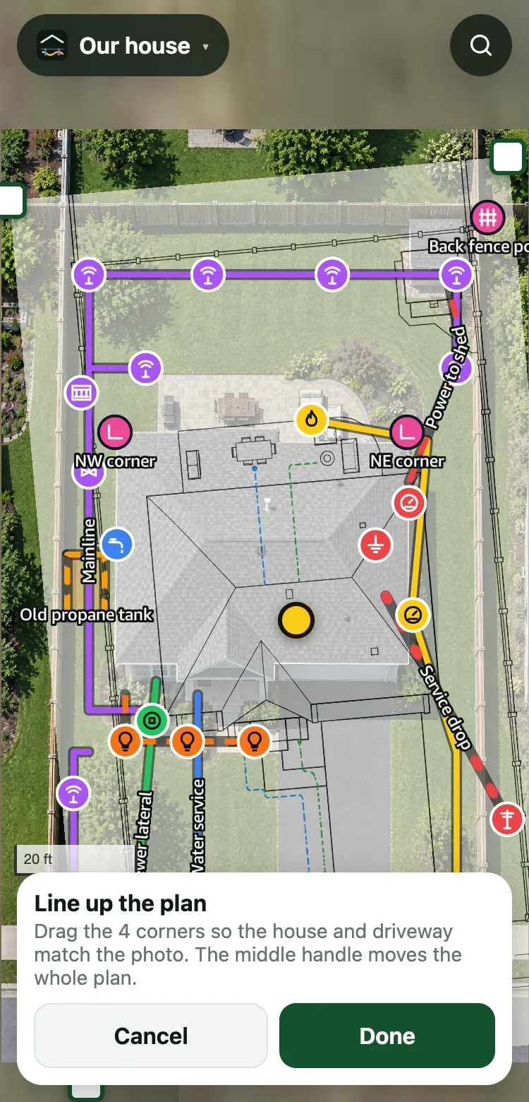
Snap a photo of the paper and lay it over the satellite view. Drag its corners until the house and driveway match, then trace what's on it onto real layers.
Got the surveyor's files? Import their CSV point file or DXF drawing and it lands in the right spot by itself. State Plane and UTM coordinates are recognised, and a local survey grid is placed from two points you can see.
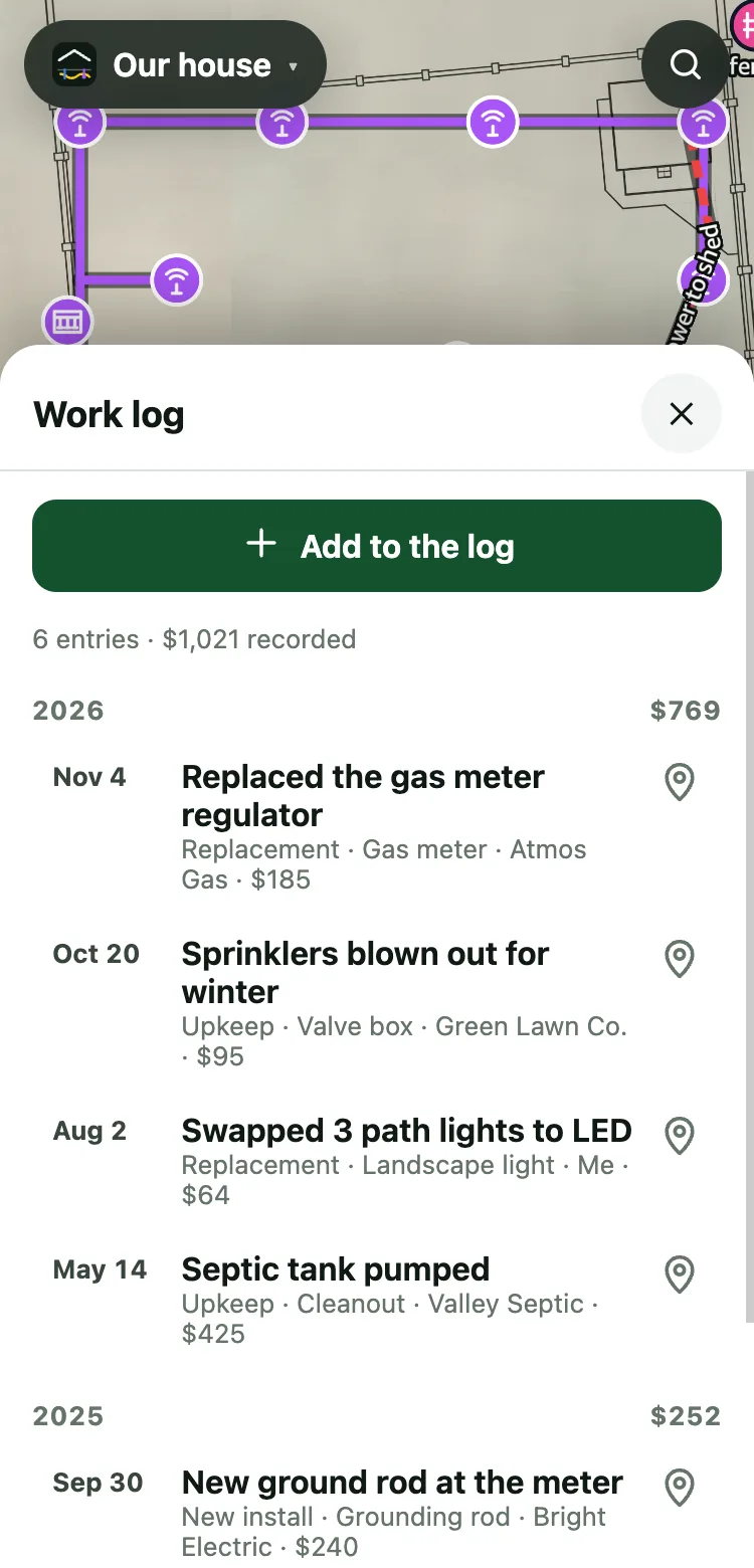
Log every repair, replacement and bit of upkeep: the date, who did it, what it cost, and a photo of the receipt. Pin it to the spot or attach it to the valve or line it was on. Tap any spot to see its history.
Export it as a spreadsheet for your records, your taxes or the next owner.
A one-minute film about where this is going.
Marking, measuring, photos, plans and the work log work today. Dig check, the emergency view, crew links and handing the map to the next owner are coming soon, and the film labels which is which.
Where your map starts paying you back.
Sketch where the fence post or tree goes. YardXray warns you about anything marked nearby, then reminds you to call 811.
One tap shows the water main, gas shutoff and panel, with photos. For you at 2 a.m., or the house-sitter.
Send the fence crew a view-only link with just the layers they need. It expires when the job's done.
When you sell, every line, photo and measurement goes with the house, plus a printable PDF.
Where your gas line and tank are is nobody else's business. Your map stays on your device today. When accounts arrive, every property stays private, and you share only through links you send. No addresses or coordinates ever go into our analytics.
It's free, and in the US it's the law. YardXray is your own record of what's in the ground. It helps you plan, but it doesn't replace having the utilities mark their lines.
$0
About $39/year
Ten minutes in the yard with your phone today saves a cracked pipe, or worse, later.
Start your map, free